News
October 15, 2006
Vitaliy Pronkin has released version 0.99.88 of WW2D.
The actual WW2DPlusOne beta 2 does not work on top of this new version. Until further notice, the best way to get it running is to use previous 0.99.87 version of WW2D.
- Download WW2D 0.99.87 (Zip 4.3M - March 24, 2006)
- Download JOGL 1.10 installer (Jar 3.3M - if needed)
Note: to complicate things a bit, the latest WW2D uses the newer JOGL implementation JSR231 which is not compatible with the previous one, namely 1.10. So if you plan on also using the latest WW2D, you may have to deal with two versions of JOGL... which may be tricky.
May 13, 2006
Faster downloads, faster rendering, better memory management... and high resolution terrain mesh when you need it. Enjoy ;)
This is an update to Vitaliy Pronkin WW2D providing a 3D view. Download and unzip in your actual WW2D directory with the directory structure preserved - that should add WW2DPlusOne.bat and WW2DPlusOne.jar, a couple icons and three other files in /Global and /Earth. Follow instructions in readme.txt.
This is beta software with still some issues and room for improvement.
- Download WW2DPlusOne_beta2.zip (839k)
- Read beta 2 release notes (text file)
- Forum thread at NASA World Wind forum/Ports
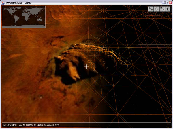
Uluru - Ayers Rock, NT, Autralia - NLT Landsat7, SRTM30Plus and HD mesh
May 7, 2006
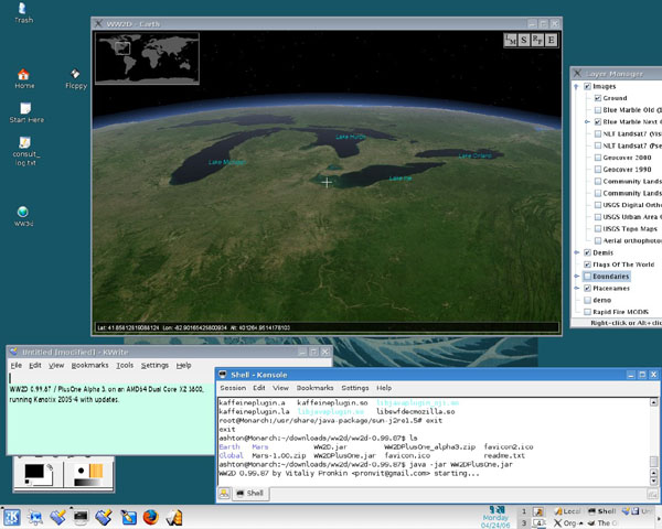
A second beta version should not be far away. Images and elevation data are now downloaded from different 'lists' and dont slow down each other anymore. Terrain rendering has been optimized with variable level of detail mesh and you can now select terrain definition... it can be quite cpu intensive in HD though. Still some annoying issues with memory and garbage collection... stay tuned ;)
April 27, 2006
Thanks to the efforts of Tishampati Dhar aka 'what-nick' in decoding 7z and Zip compressed SRTM data, WW2DPlusOne is now in beta testing and optimization stage. Enjoy full Lansat coverage with (somehow) accurate relief. Still many issues to solve - see release notes. Earth terrain elevation only for now.
This is an update to Vitaliy Pronkin WW2D providing a 3D view. Download and unzip in your actual WW2D directory with the directory structure preserved - that should add WW2DPlusOne.jar, a couple icons and three other files in /Global and /Earth. Follow instructions in readme.txt.
This is beta software with a lot of room for improvement.
- Download WW2DPlusOne_beta1.zip (824k)
- Read beta release notes (text file)
- Forum thread at NASA World Wind forum/Ports
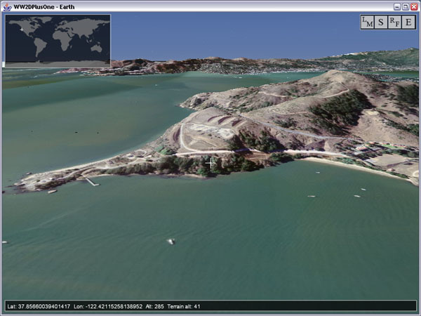
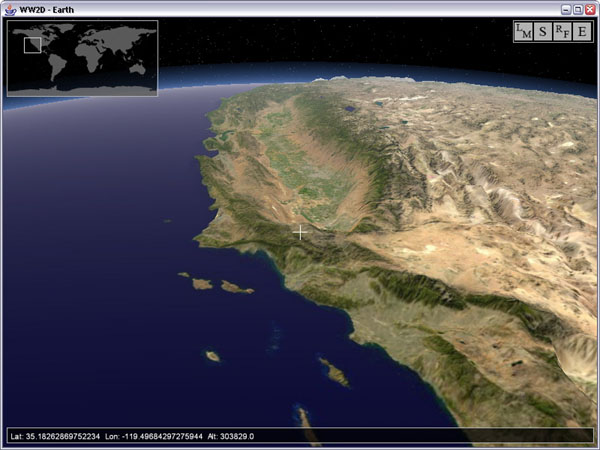
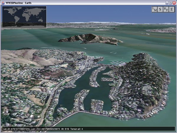
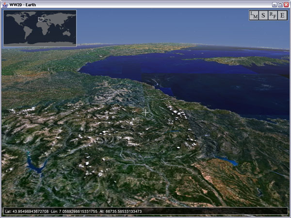
San Francisco area, USGS Urban Area Ortho & SRTM30Plus
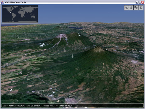
Guatemala volcanoes, NLT Landsat & SRTM30Plus
April 23, 2006
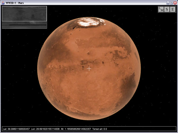
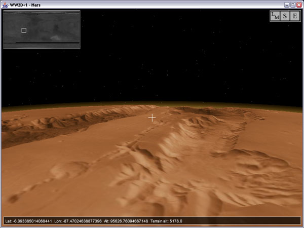
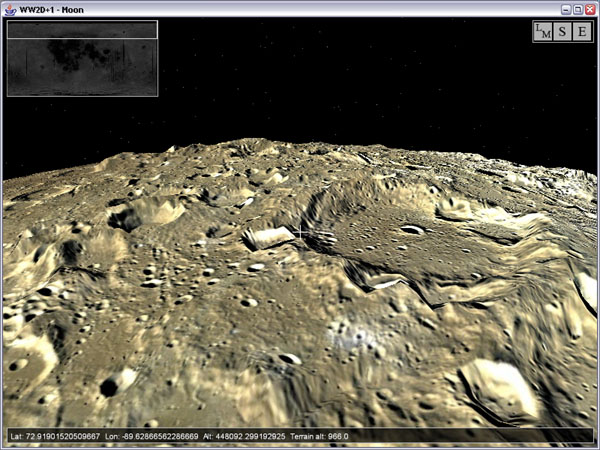
Thanks to the new version 1.3.4 of Nasa World Wind and the efforts of many community members, we have now access to more detailed data sets for the Moon and Mars... and we can also have terrain elevation :) I couldnt resist to have a look at Mars with the coming beta 1 (more at the page bottom):
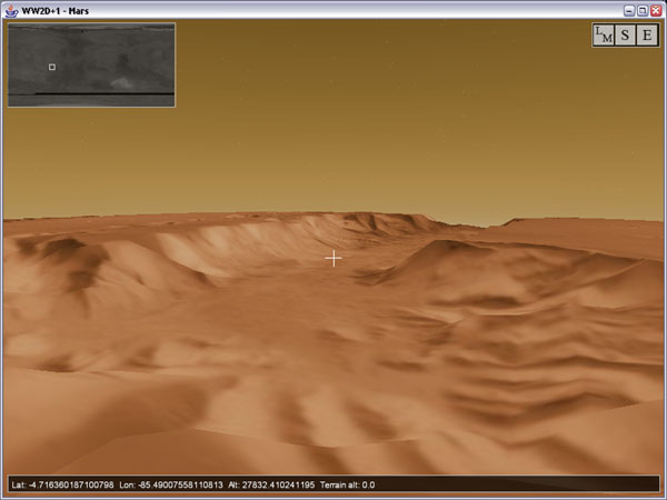
Mars with MOC 256 colorized & Mola 128 elevation data
Note : you can have the same martian sky in NWW with the Sky Gradient plug-in
April 21, 2006
I finally started coding for SRTM data (terrain elevation) and apart from some tweaking... and decompressing 7z files, the terrain is getting more detailled by the hour. I hope to pack a decent terrain accessor soon and to move to beta testing and tuning. More screen shots added at the page bottom ;)
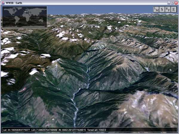
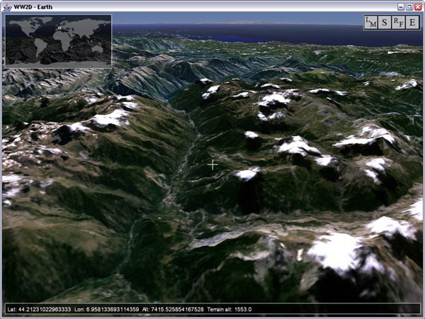
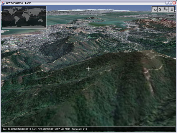
French Alps with NLT Lansat and SRTM data
April 17, 2006
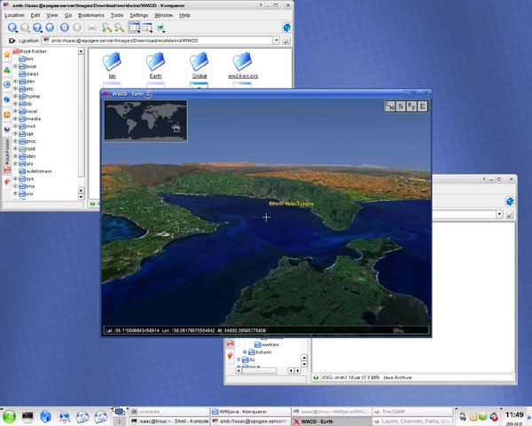
The 3D view is getting better. Smarter updating and memory management. Ctrl+F toggles the fog. Shift +/- controls the camera field of view (zoom). Still no STRM data and some issues with the view frustrum when close to the ground.
This is an update to Vitaliy Pronkin WW2D providing a 3D view. Download and unzip in your actual WW2D directory with the directory structure preserved - that should add WW2DPlusOne.jar, a couple icons and two other files in /Global and /Earth. To launch, double click WW2DPlusOne.jar instead of WW2D.jar.
This is alpha software and is only really usable with the Blue Marble layers or vertical exaggeration set to zero (Key 0) - coarse terrain elevation for now.
- Download WW2DPlusOne_alpha3.zip (816k)
- Read alpha release notes (text file)
- Forum thread at NASA World Wind forum/Ports
April 13, 2006
This is an update to Vitaliy Pronkin WW2D providing a 3D view.
Download and unzip in your actual WW2D directory with the directory structure preserved - that should add WW2DPlusOne.jar and two other files in /Global and /Earth. To launch, double click WW2DPlusOne.jar instead of WW2D.jar.
This is alpha software and is only really usable with the Blue Marble layers - Coarse terrain elevation for now.
- Download WW2DPlusOne_alpha2.zip (796k)
- Read alpha release notes (text file)
- Forum thread at NASA World Wind forum/Ports
April 10, 2006
Things are coming together with the 3D view in WW2D... and NWW users would even feel at home. The right mouse button now controls the camera tilt and heading and keys 0 to 9 set the vertical exaggeration.
I couldnt resist to port some of my WW plug-ins too - stars, sky gradient and fog ;)
However SRTM data are not in yet, the alpha version use a global 'bumpmap'. Hopefully Vitaliy will find time to put together a terrain accessor.
Still a lot of room for tuning and improvement...
So far i would say that Java/JOGL delivers a decent performance.
I hope we will be able to provide some beta version before summer...